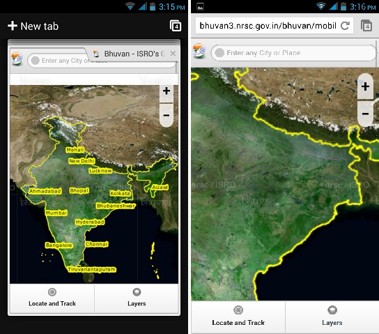
Satellite-supported mapping apps are quite in now. In fact, even the Indian Space Research Organization has decided to compete with them, by launching its own mapping app called Bhuvan. Bhuvan is something designed on the lines of Google Earth with support and data from Indian satellites. This is a first of its kind of effort from the Indian space agency. Mobile users can access bhuvan3.nrsc.gov.in/bhuvan/mobile/mobile.html and Android users can download the apk.

The app is pretty simple, though, no fireworks. The app provides a map resembling what is shown generally on Google Earth. All you need to do to use the app is put in the name of a city or a location in top search bar and it will zoom in on the satellite view of the place. Or you can click on ‘Locate and track’ to know your phone’s GPS location. Although as you zoom in, it gets weirdly blurry with the ISRO/Bhuvan watermark all over the place. There is also a ‘layers’ option which shows railway tracks, roads, highways and towns/cities. It doesn’t exactly measure up against Google Earth though since it shows roads borders, places photos and 3D imagery too.
It is kind of a surprise that the National Remote Sensing Centre (NRSC) which is behind the app, hasn’t submitted it to the Google Play Store. It has instead provided an apk file on its site instead, which will make people even more hesitant in trying the app. Just like Google Earth users, Bhuvan users can add content. It allows users to add Point of Interest (POI) data under ‘My content’, although what will actually become of that content, we aren’t sure. You can see the content under ‘unverified content’.
All in all, the app is a new effort from ISRO, but needs to be improved upon (a lot!) to actually count as something for mobile users.

