With the rise in pollution it’s really necessary to be aware of your surrounding and it’s air quality to stay healthy and fit or protect someone with other health related issues. Seeing this, Google Maps which already helps you navigate through roads while avoiding traffic and tolls has added a new air quality layer that helps users quickly monitor the air quality index (AQI) at and around their destination.
That said, here’s a guide that explains how you too can use the new air quality feature on your smartphone using Google Maps:
- Open Google Maps on any supported device.
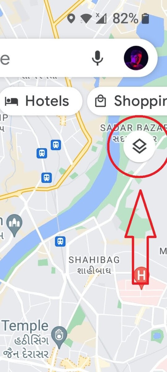
- Once inside the app tap on the layers icon that can be found below the search bar on the right side of the app.
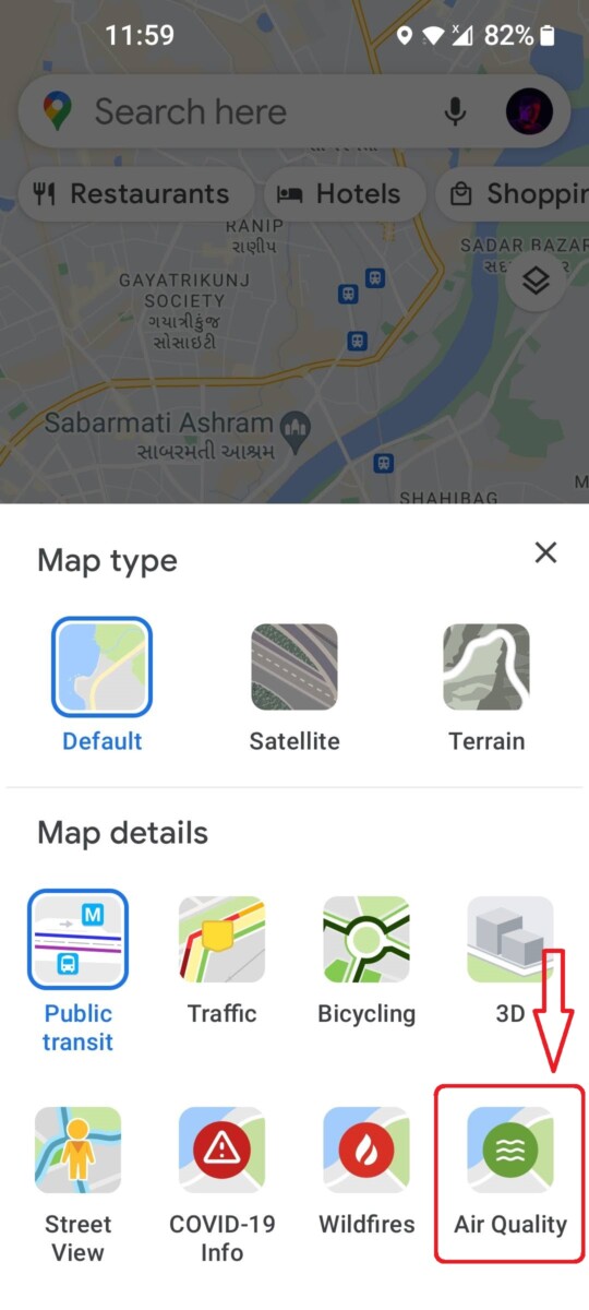
- Now from the variety of icons that appear on the screen select Air Quality which is listed under Map details.
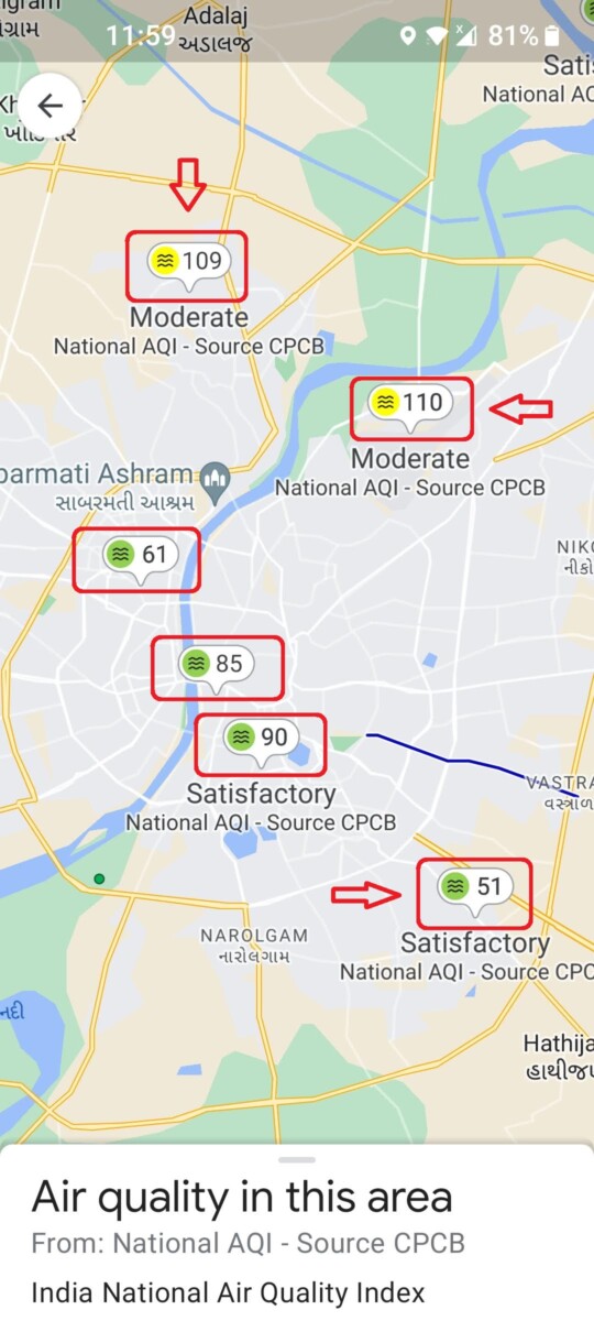
- Once enabled, nearby air quality monitoring stations appear as small colour-coded bubbles on the screen accompanied by an air quality score.
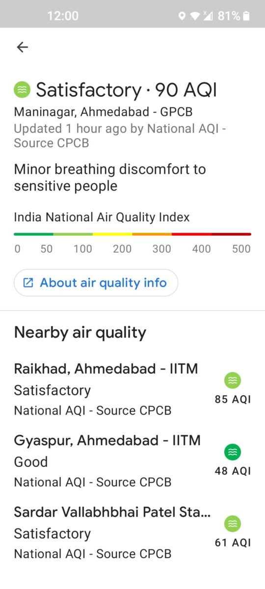
- You can also tap on the bubbles to access more detailed report regarding a particular area’s air quality.
That’s pretty much how you too can monitor Air Quality Index of a specific area right from your smartphone.


