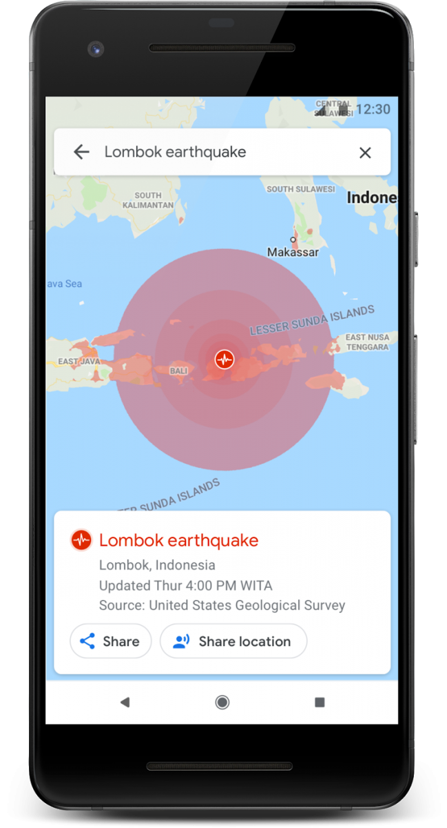
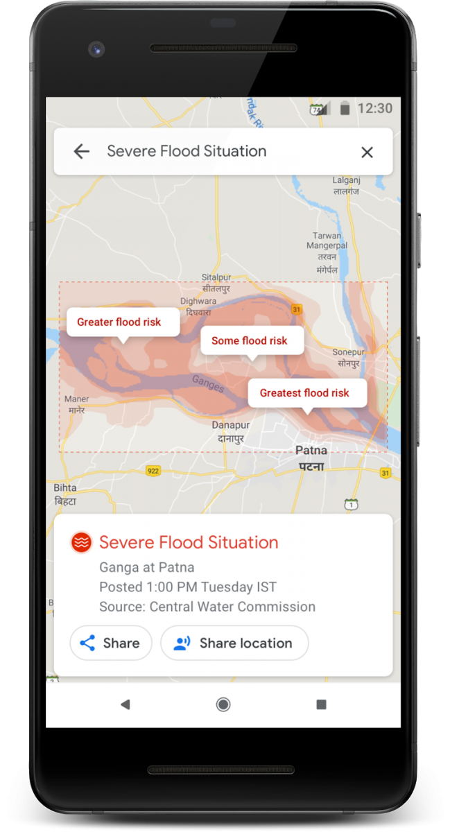
Google has announced that it is improving SOS alerts on Maps and Search by adding visual information about natural disasters. It is also adding a new navigation warning system on Google Maps so you can more reliably know where a disaster is and anticipate where it’s headed.
With the SOS alerts, users can see important crisis information, including a summary of what’s happening, relevant news stories, emergency phone numbers, and websites, Twitter updates from local authorities, and tips to help find a way to safety.

It will show detailed visualizations about hurricanes, earthquakes, and floods and provide a better understanding of the situation on the ground.
The company will be showing a crisis notification card on Google Maps that automatically appears when the user is near the impacted area. This card will direct users to a hurricane forecast cone, which shows the prediction of the storm’s trajectory along with information about what time it’s likely to hit certain areas, enabling users to plan how to react.
After an earthquake strikes, tapping on the crisis card will display the earthquake’s shakemap—a visualization that shows its epicenter, its magnitude, along with color coding to indicate how intense the shaking was in surrounding areas.

In India, where over 20 percent of global flood-related fatalities occur, users will be able to see flood forecasts that show where flooding is likely to occur in addition to the expected severity in different areas.
During the crisis, there are three other ways you can use Google Maps to stay connected and quickly get help and information. You can share your location to let your loved ones know where you are. From the crisis card, you can share your live location with friends and family for as little as 15 minutes, or until you decide to stop sharing.
You can also turn on the traffic layer to see all known and suspected road closures in an area. Also, you can tap on the share button from the crisis card to keep friends and family up to date about the situation. They’ll be directed to Google Maps where they’ll see all available crisis information.

